Jesuit Missions Maps

Jesuit Missions Home Page | Tourism | Santa Cruz | Plan Your Trip
Below you'll find scanned Jesuit Missions maps from various sources, which zoom in on specific towns and regions. You'll also find Google maps of specific Jesuit Missions towns. You can toggle between the satellite view and street view of each town. Some of these maps of the Jesuit Missions merely show their locations in relation to other towns and cities. Others show driving distances. Some of these Jesuit Missions maps were provided by the
Mancomunidad Chiquitana
others by the Santa Cruz
Tourist Information Office
and some we purchased. Under no circumstances do any of these maps belong to us and any use of the BoliviaBella logo is purely to discourage other websites from using the images. We'll credit each source.
Map of Bolivia San Javier and Concepción
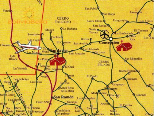
Map produced by FRANCO PRODUCCIONES and available in bookstores
SAN JAVIER
CONCEPCION
Map of Bolivia showing distances from Santa Cruz to Northern Jesuit Missions
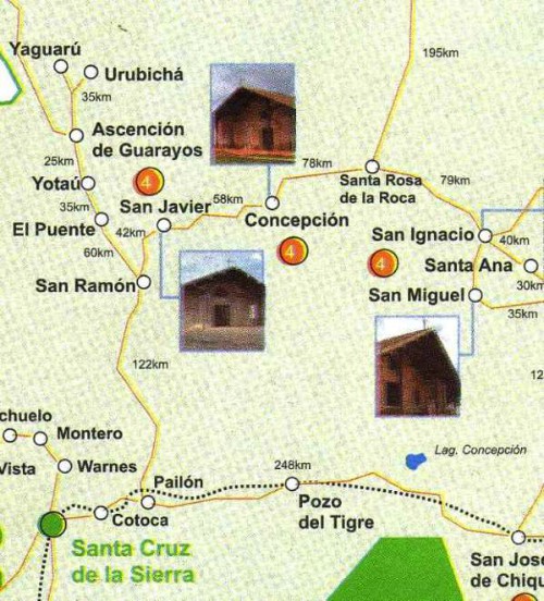
Map provided by the Santa Cruz Tourist Information Office
Map of Bolivia showing distances between the Jesuit Missions and Noel Kempff National Park
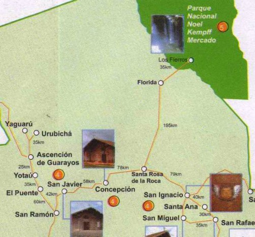
Map provided by the Santa Cruz Tourist Information Office
Map showing distances to Puerto Suarez
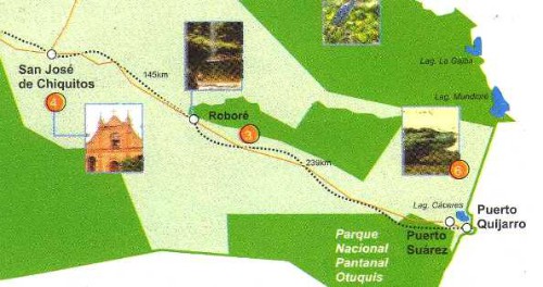
Map provided by the Santa Cruz Tourist Information Office
PUERTO SUAREZ
Map of Bolivia showing distances between Santa Cruz, San José de Chiquitos and Roboré

Map provided by the Santa Cruz Tourist Information Office
SAN JOSE DE CHIQUITOS
ROBORE
Map of Bolivia showing distances between San Ignacio de Velasco and San Matías

Map provided by the Santa Cruz Tourist Information Office
SAN IGNACIO DE VELASCO
SAN MATIAS
Map of Bolivia showing San Ignacio, San Rafael, Santa Ana and San Miguel
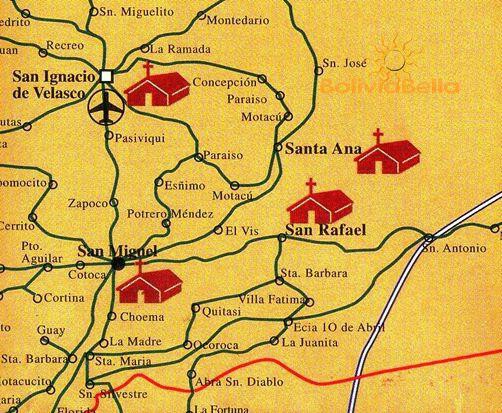
Map produced by FRANCO PRODUCCIONES and available in bookstores
SAN RAFAEL
SANTA ANA
SAN MIGUEL
Map of Bolivia showing San José de Chiquitos, Roboré and Santiago de Chiquitos
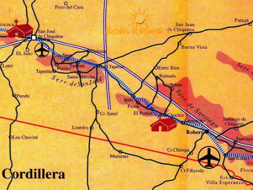
Map produced by FRANCO PRODUCCIONES and available in bookstores
SANTIAGO DE CHIQUITOS
Map of Bolivia showing San Matías and vicinity
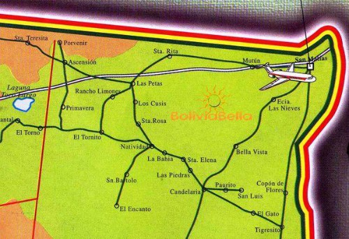
Map produced by FRANCO PRODUCCIONES and available in bookstores
Map of Bolivia showing all the Jesuit Missions North and East of Santa Cruz (the 7-town tour)
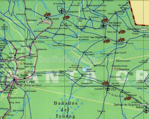
Map produced by FRANCO PRODUCCIONES and available in bookstores
Map of Bolivia showing San Javier, Concepción, Ascención de Guarayos and Urubichá
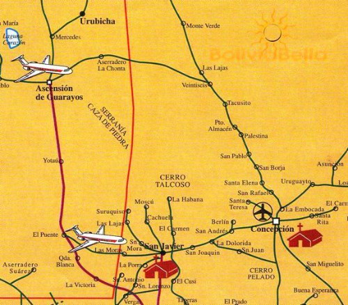
Map produced by FRANCO PRODUCCIONES and available in bookstores
ASCENCION DE GUARAYOS
Jesuit Missions Home Page | Tourism | Santa Cruz | Plan Your Trip
   
Click here to get a link to this page for your blog or website.
Would you prefer to share this page with others by linking to it?
- Click on the HTML link code below.
- Copy and paste it, adding a note of your own, into your blog, a Web page, forums, a blog comment,
your Facebook account, or anywhere that someone would find this page valuable.
|


